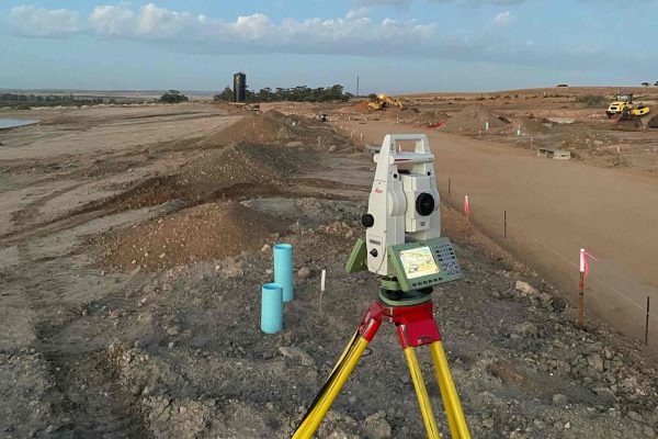
When it comes to land development, one of the most critical steps is properly dividing land into manageable parcels. Land divisions, whether for residential, commercial, or agricultural purposes, must be handled with precision and care. This ensures that property rights are clearly defined and legal disputes are avoided. One key element in the success of land divisions is the involvement of professional land surveyors, who play a crucial role in accurately mapping out property boundaries and ensuring the legal integrity of land transactions.
The Importance of Accurate Land Divisions
Land divisions involve the partitioning of large tracts of land into smaller, individual lots. This can be for a variety of reasons, such as residential developments, commercial zoning, or agricultural use. Regardless of the purpose, proper land divisions are essential for several reasons:
- Legal Clarity: Clear and precise boundaries are essential to prevent future disputes between neighbors or property owners. Without proper documentation, misunderstandings or legal conflicts can arise, potentially leading to costly litigation.
- Marketability of Land: Well-defined land divisions increase the marketability of the property. Buyers and investors are more likely to consider parcels that are legally recognized, with clear boundaries and ownership rights.
- Regulatory Compliance: Different regions have specific zoning laws and land-use regulations that must be adhered to when dividing land. Proper land divisions ensure compliance with these laws, avoiding costly fines or legal challenges later.
- Value Assessment: Accurate land divisions help assess the value of each lot based on its size, shape, and potential for development. This is crucial for both buyers and sellers to determine fair pricing and maximize return on investment.
The Role of Land Surveyors in the Division Process
Land surveyors are integral to ensuring that land divisions are carried out successfully. These professionals use a combination of modern technology and their expertise to accurately measure and map property boundaries. Here are a few ways land surveyors contribute to the process:
1. Boundary Determination
Land surveyors are trained to identify and mark the exact boundaries of a property. They use historical records, physical markers, and advanced surveying tools such as GPS and total stations to establish the precise lines of ownership. This is vital when dividing land to avoid encroachment on adjacent properties or violating legal property lines.
2. Creating Survey Maps
Once the boundaries are determined, land surveyors create detailed survey maps. These maps outline the property lines, dimensions, and any natural or man-made features, such as roads, rivers, or buildings, that may impact the land division. These maps are essential for submitting legal documents and for guiding future development plans.

3. Compliance with Local Laws
Land surveyors are knowledgeable about local zoning and land-use regulations. When dividing land, they ensure that the new divisions comply with municipal codes and other legal requirements. This ensures that the land can be legally developed or sold according to local regulations, thus preventing future complications.
4. Resolving Disputes
In some cases, land divisions can lead to disputes between adjacent property owners. A land surveyor can play a key role in resolving these conflicts by providing expert testimony and evidence to clarify boundary lines. Their work is often used in legal proceedings to settle ownership disputes or clarify easements and rights of way.
The Process of Land Divisions
The process of land divisions generally follows a few essential steps:
- Pre-Survey Planning: This involves gathering information, such as current property deeds, historical surveys, and zoning laws. The land surveyor may also meet with the property owner to discuss goals for the division.
- Surveying and Mapping: The land surveyor then conducts a field survey to determine the boundaries, elevations, and features of the property. Using this information, they create a detailed map that represents the property’s current status.
- Subdivision Application: Once the survey map is complete, the property owner may need to submit it to the local government for approval. This often includes ensuring that the new divisions comply with zoning regulations and access requirements.
- Final Approval and Documentation: Once the land divisions are approved, the property owner can proceed with selling, developing, or utilizing the new parcels. Official records and deeds are updated to reflect the new boundaries.
Conclusion
Proper land divisions are essential for both legal and property success. By working with skilled land surveyors, property owners can ensure that their land is divided accurately, legally, and efficiently. Accurate surveys not only protect legal rights but also maximize the potential for development, sales, and investments. Whether for personal use, business expansion, or community development, effective land divisions create a solid foundation for long-term success.


